Best Parks in Puerto Rico: National Forest, State Forests & Wildlife Reserves
Puerto Rico has more protected land than its compact size suggests. The island is home to El Yunque — the only tropical rainforest in the United States National Forest system — plus 20 state forests managed by the Puerto Rico DRNA, two National Wildlife Refuges on inhabited offshore islands, several coastal and marine protected areas, a UNESCO Biosphere Reserve, and one of the largest cave park systems in the Western Hemisphere. Together these parks cover terrain ranging from Caribbean dry forest to cloud-forest peaks above 4,000 feet. This guide maps every major protected area, what you can do in each, which require advance permits, and how to connect park visits with tours and activities across the island.
Explore El Yunque on a guided tour from San Juan
Browse El Yunque Tours →Quick-Reference: Puerto Rico Parks at a Glance
| Park / Reserve | Type | Region | Key Draw |
|---|---|---|---|
| El Yunque | US National Forest | Northeast | Waterfalls, hiking, endemic birds |
| Toro Negro | State Forest | Central mountains | Cerro de Punta summit, Doña Juana Falls |
| Guánica | State Forest + UNESCO Biosphere | South coast | Dry forest, rare birds, coastal cliffs |
| Las Cabezas de San Juan | Nature Reserve | Fajardo, NE | Bio bay, lighthouse, mangroves |
| Vieques NWR | US Wildlife Refuge | Vieques Island | Wild horses, bio bay, empty beaches |
| Cabo Rojo NWR | US Wildlife Refuge | Southwest | Salt flats, migratory birds, lighthouse |
| Río Camuy Cave Park | State Park (DRNA) | Northwest | Cave river system, sinkhole |
| Mona Island | Nature Reserve | Offshore, west | Caves, sea turtles, iguanas (permit required) |
| Guajataca State Forest | State Forest | Northwest | Karst mogotes, lake, cave |
El Yunque National Forest
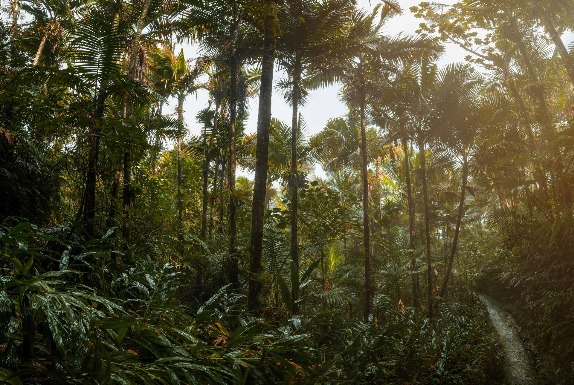
El Yunque is Puerto Rico's crown jewel and the only tropical rainforest administered by the US Forest Service. Its 28,000 acres in the Sierra de Luquillo mountains northeast of San Juan receive up to 200 inches of rain per year at higher elevations, sustaining cloud forest, multiple waterfalls, and a biodiversity density that surpasses most temperate national forests many times its size.
The forest rises from lowland tabonuco forest at its base to sierra palm and dwarf cloud forest near the summits. Waterfalls are the main visitor draw — La Mina Falls (reached by paved trail), La Coca Falls (roadside), and Juan Diego Falls (moderate trail) are the most accessible. For hikers, the El Toro and El Yunque peak trails reach the forest's highest terrain with views on clear days to the north coast and out over the Atlantic.
Wildlife highlights: the Puerto Rican parrot, one of the rarest birds in the world, has a managed recovery population in El Yunque. Coquí frogs call from every trail. Puerto Rican boa constrictors inhabit the understory. Over 240 tree species and dozens of endemic plants make the forest one of the most botanically rich temperate-accessible ecosystems in the US.
- Distance from San Juan: ~40 minutes east via PR-3 and PR-191
- Entry fee: Recreation fee for certain trailhead parking; check USFS El Yunque
- Trail conditions: Some trails remain affected by storm damage — check USFS for current closures
- Guided tours: Available from San Juan daily; see El Yunque tours
See the full guide: El Yunque: America's Only Tropical National Forest.
Puerto Rico State Forests
Puerto Rico's DRNA manages over 20 state forests covering terrain from the northwest karst plateau to the south coast dry hills. They vary enormously in infrastructure: some have ranger stations, trails, and campgrounds; others are largely undeveloped tracts accessible only to experienced hikers with local knowledge. For current hours, fees, and camping permits at any state forest, contact the DRNA — conditions and services change.
Toro Negro State Forest
Toro Negro is Puerto Rico's largest state forest by area and contains the island's highest point: Cerro de Punta, at 4,390 feet (1,338 meters). The forest covers the central cordillera near Orocovis and Jayuya, and its upper elevations have a distinctly different climate from the coast — noticeably cooler, often misty, with a cloud forest character at higher elevations. The forest contains Doña Juana Falls, a multi-tier cascade with a swimmable pool accessible by trail.
The summit road to Cerro de Punta makes the peak accessible without a demanding climb. Views from the top — weather permitting — extend across the island in multiple directions. Toro Negro is best reached from Orocovis or along PR-143 (the Ruta Panorámica), Puerto Rico's scenic mountain highway. Allow a full day; roads are slow and winding.
Guánica Dry Forest – UNESCO Biosphere Reserve
Bosque Seco de Guánica on the south coast is one of the finest examples of subtropical dry tropical forest in the world and was designated a UNESCO Biosphere Reserve in 1981. The landscape is striking in its difference from El Yunque: cacti, spiny bromeliads, and drought-adapted trees replace the rainforest's dripping ferns and palms. More than 700 plant species and over 130 bird species have been recorded here, including multiple Puerto Rican endemics.
The forest occupies the low hills above the south coast near Guánica town and extends to the coast, where limestone cliffs drop to clear Caribbean water. Hiking trails are maintained through the forest; a ranger station near the main entrance provides maps. Because the south coast is drier and hotter than the northeast, early morning is the best time to hike.
Guajataca State Forest
Guajataca State Forest in the northwest, near Isabela, sits on the edge of the karst mogote landscape and contains Lago Guajataca — a reservoir surrounded by forested hills — along with trails through the mogotes and access to karst caves within the forest. The forest is close to Río Camuy Cave Park, making a combined Guajataca-Camuy day feasible. There's also a short tunnel (the Guajataca Tunnel) from the railroad era that passes through one of the forest's limestone ridges.
Other Notable State Forests
- Maricao State Forest: Western mountains, coffee country, notable for bird diversity and the Monte del Estado summit tower
- Carite State Forest: Southeast, near Guayama, blue-pool swimming area, cool temperatures
- Río Abajo State Forest: Northwest, large forest with the Puerto Rican parrot aviary (captive breeding program)
National Wildlife Refuges
Vieques National Wildlife Refuge
The Vieques NWR covers the eastern and western portions of Vieques Island — land that was used by the US Navy for decades and transferred to the US Fish and Wildlife Service in 2003. The refuge encompasses former military range land, scrub forest, mangroves, and beaches. The eastern section includes some of Vieques's most remote and beautiful beaches, accessible by unpaved roads that require a high-clearance vehicle or on foot.
The refuge is also where Mosquito Bay — Vieques's celebrated bioluminescent bay — sits, managed as part of the protected area. Wild horses graze across the refuge and the rest of the island freely. Sea turtle nesting occurs on the refuge beaches. The lack of development means that many of the refuge's beaches feel genuinely wild. Check with US Fish and Wildlife for current access conditions and any temporary closures.
See: Vieques tours and the wild horses of Vieques.
Cabo Rojo National Wildlife Refuge
The Cabo Rojo NWR at Puerto Rico's southwestern tip protects the salt flats, seasonal wetlands, and dry coastal scrub around the Boquerón area. The salt flats — still used for commercial salt production — attract large numbers of migratory shorebirds during the winter months, making Cabo Rojo one of the premier birding destinations in the Caribbean. The refuge connects directly to Los Morrillos Lighthouse, a 19th-century lighthouse perched above 160-foot sea cliffs at the island's true southwestern corner.
Culebra National Wildlife Refuge
The Culebra NWR protects most of the small islands surrounding Culebra and portions of the main island, including key seabird nesting areas. The refuge hosts nesting colonies of brown boobies, frigatebirds, and several tern species, as well as sea turtle nesting beaches. The protection afforded by refuge status has contributed to the marine ecosystem quality that makes Culebra's snorkeling and diving waters exceptional.
Coastal & Marine Reserves
Las Cabezas de San Juan Nature Reserve
Las Cabezas de San Juan in Fajardo, managed by the Conservation Trust of Puerto Rico, protects a headland on the northeast coast that encompasses seven different ecosystems — including mangroves, a coral reef lagoon, dry forest, freshwater lagoon, and rocky coastline — in a compact area. The site contains one of the island's three bioluminescent bays (Laguna Grande), the El Faro lighthouse (in operation since 1882 and one of the most photographed in Puerto Rico), and trails through mangrove and dry forest ecosystems.
Access requires advance reservation — the Trust does not accept walk-ins. Guided tours run on scheduled departures and cover the lighthouse, boardwalk trails, and the bio bay on evening tours. See Fajardo tours for booking options.
Jobos Bay National Estuarine Research Reserve
The Jobos Bay NERR near Guayama on the southeast coast protects the largest remaining mangrove system in Puerto Rico. As a National Estuarine Research Reserve it is managed jointly by NOAA and the DRNA for research, education, and conservation. Guided kayak and interpretive tours of the mangrove systems are available; contact the NERR for current programs.
Cave Parks & Heritage Sites
Parque Nacional de las Cavernas del Río Camuy
The Río Camuy Cave System — one of the largest cave river systems in the Western Hemisphere — is protected and managed as a state park by the DRNA. The public-access portion centers on Clara Cave, reached by trolley from the park entrance. See the complete guide at Caves in Puerto Rico.
Caguana Indigenous Ceremonial Park
Caguana near Utuado preserves the most important known Taíno ceremonial site in Puerto Rico — a complex of batey (ball courts) and monoliths that served as a ritual center for the pre-Columbian indigenous population. The site is managed by the Institute of Puerto Rican Culture. The surrounding forested hills add to the atmosphere.
Mona Island Natural Reserve
Mona Island, 50 miles off the west coast in the Mona Passage, is one of Puerto Rico's most isolated natural reserves. The island has no permanent human population and is accessible only by chartered boat from Mayagüez or Joyuda. A DRNA permit is required before visiting. The island hosts colonies of Mona ground iguanas (endemic), sea turtle nesting beaches, extensive sea-level caves with Taíno pictographs, and remarkable isolation. For serious naturalists and adventurers only — this is an expedition, not a day trip.
Planning: Which Parks to Visit
For most first-time visitors, El Yunque covers the primary park experience within a half-day. A second park day might combine Las Cabezas de San Juan with Fajardo water activities, or take the Ruta Panorámica through the central mountains to Toro Negro. The south coast's Guánica Dry Forest pairs well with Ponce. The offshore refuges — Vieques and Culebra — each merit a full day or overnight stay.
Frequently Asked Questions
What is the best park in Puerto Rico?
El Yunque National Forest is the most visited and most accessible — 40 minutes from San Juan with well-maintained trails and several waterfalls. For wildlife diversity, Vieques NWR is exceptional. For a unique ecosystem unlike anything else, Guánica Dry Forest is unmatched.
How do I get to El Yunque?
El Yunque is about 40 minutes east of San Juan via PR-3 and PR-191. Guided tours with transportation depart daily from San Juan; see El Yunque tours. With a rental car, follow signs for El Yunque Recreation Area from PR-191.
Is Puerto Rico good for bird watching?
Puerto Rico has 19 endemic bird species found nowhere else in the world. El Yunque, Guánica Dry Forest, Cabo Rojo NWR, and Río Abajo State Forest are the four best birding sites. The Puerto Rican parrot, Puerto Rican tody, and Puerto Rican woodpecker are among the most sought species. The dry season (December–April) is optimal for birding.
Can you hike in Puerto Rico parks?
Yes — El Yunque, Toro Negro, Guánica, and Guajataca all have maintained hiking trails. Difficulty ranges from paved, family-accessible routes in El Yunque to rugged backcountry in Toro Negro and the karst forests. Check trail conditions and closures before visiting. See Best Hikes in Puerto Rico for trail-by-trail guidance.
Book guided El Yunque tours from San Juan
Browse El Yunque Tours →