 Wander Puerto Rico
Puerto Rico Road Trip Guide: Scenic Routes, Driving Tips & Itinerary
Puerto Rico is one of the best road trip islands in the Caribbean. It's small enough to cross in a few hours but packed with enough variety — rainforests, mountain coffee towns, bioluminescent bays, surf beaches, colonial cities — that a week behind the wheel barely scratches the surface. No international license needed, no border crossings, no language barrier you can't navigate. Rent a car, turn on Waze, and go.
Best Scenic Drives
Ruta Panorámica (Central Mountain Spine)
Distance: 167 miles east to west · Time: 2–3 days with stops
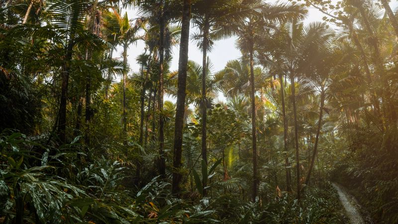
The island's signature drive — a winding route through the central mountains connecting over 40 smaller roads across Puerto Rico's highest peaks. You'll pass through coffee plantations, cloud forest, tiny mountain towns, and get views of both coasts on clear days. Highlights include Cerro de Punta (the island's highest point at 4,390 ft), Toro Negro State Forest, and the Adjuntas coffee region. The roads are narrow and winding — drive slow, stop often, and enjoy it.
North Coast: San Juan to Arecibo
Distance: 75 miles · Time: Half day with stops
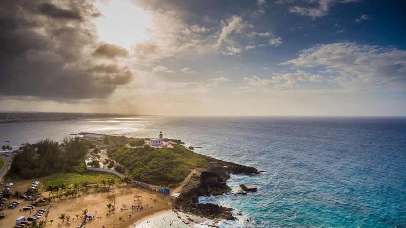
Take Route 681/Route 2 west along the north coast. Stop at Dorado Beach for a swim, the Arecibo Lighthouse for ocean views, Cueva del Indio for sea caves with Taíno petroglyphs, and finish at the Río Camuy Cave Park. The north coast is greener and more dramatic than you'd expect — limestone karst hills, crashing waves, and roadside coconut vendors.
East Coast: San Juan to Fajardo via El Yunque
Distance: 45 miles · Time: Full day with hikes
Drive Route 3 east to El Yunque, hike to waterfalls, then continue to Luquillo Beach and the kioskos for lunch. End in Fajardo for a sunset bio bay kayak tour. This is the most popular day-trip loop from San Juan and works as the first leg of a longer road trip heading south.
Southwest Corner: Cabo Rojo & Guánica
Distance: 30 miles loop · Time: Full day
The southwest is Puerto Rico's driest, sunniest region — and its most underrated. Drive to Playa Sucia (one of the island's best beaches, behind the salt flats), hike to the Cabo Rojo Lighthouse on dramatic red cliffs, then head to Guánica Dry Forest (a UNESCO Biosphere Reserve). Finish at La Parguera for a different bioluminescent bay experience. Almost no tourists here.
West Coast Sunset Drive: Aguadilla to Cabo Rojo
Distance: 60 miles · Time: Half day
Follow Route 2 south along the west coast through Rincón (stop for sunset), Mayagüez (the island's third-largest city), and down to Cabo Rojo. The west coast faces open ocean with the best sunsets in Puerto Rico. Rincón alone is worth a 2-night stop for the surf, food, and vibe.
The stop everyone remembers most
Book a Bio Bay Night Tour →5-Day Island Loop Itinerary
Day 1: San Juan → East Coast → Fajardo
Pick up rental car at SJU. Drive east to El Yunque Rainforest (hike La Mina Falls). Lunch at Luquillo kioskos. Continue to Fajardo. Evening: bio bay kayak tour. Sleep in Fajardo.
Day 2: Fajardo → South Coast → Ponce
Drive south along the coast through Humacao and Yabucoa. Stop at Guavate lechoneras for lunch (detour inland on Route 184 — worth it). Continue to Ponce. Walk the historic plaza, visit Parque de Bombas, dinner at a local fonda. Sleep in Ponce.
Day 3: Ponce → Southwest → Cabo Rojo
Drive west to Guánica Dry Forest (morning hike). Continue to Cabo Rojo — Playa Sucia beach, salt flats, lighthouse hike. Late afternoon at La Parguera waterfront. Sleep in Cabo Rojo or Lajas area.
Day 4: Cabo Rojo → West Coast → Rincón
Drive north along the west coast through Mayagüez. Stop for coffee in the Maricao hills if you want a mountain detour. Arrive in Rincón by early afternoon — beach time, surf lesson if interested. Watch the sunset from one of the beachfront restaurants or the Punta Higüera lighthouse. Sleep in Rincón.
Day 5: Rincón → North Coast → San Juan
Morning beach time or breakfast in Rincón. Drive east along the north coast — stop at Arecibo Lighthouse and Cueva del Indio. Optional: Río Camuy Cave Park. Continue on Route 22 back to San Juan. Return car at SJU or keep for Old San Juan exploration. Total drive: about 2.5 hours without stops.
Driving Tips
Renting a car
Book at SJU airport for the best rates and selection — $40–$70/day. Major agencies (Hertz, Avis, Enterprise) and locals (Charlie Car Rental) are all there. Book 2–4 weeks ahead for peak season (December–April). A compact car handles most roads fine. Get an SUV only if you're doing mountain backroads or Vieques.
Navigation
Use Waze — locals swear by it for traffic and road conditions. Google Maps works too. Download offline maps before heading into the mountains where cell service gets spotty. Road signs use kilometers for distance and miles per hour for speed — it's confusing but you get used to it.
Gas & costs
Gas is sold by the liter (about $0.80–$1.00/liter). Gas stations are everywhere on main roads but sparse in the mountains and southwest — fill up before heading into rural areas. Toll roads (AutoExpreso) connect San Juan to major cities and save time; tolls are $0.75–$3.00 per plaza. Rental cars usually have a transponder.
Watch out for
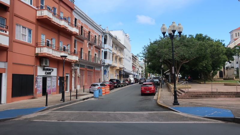
Aggressive drivers: Locals drive fast and pass aggressively, especially on mountain curves. Stay in the right lane on highways and let them go. Potholes: Secondary roads can have unmarked potholes — drive slower at night. Parking in Old San Juan: Extremely limited. Use a parking garage ($10–$15/day) or skip the car entirely when staying there. One-way streets: Old San Juan and Ponce have confusing one-way patterns — trust GPS.
Insurance
Your US auto insurance and most credit cards cover Puerto Rico (it's a US territory). Check with your provider before buying the rental agency's coverage. Liability is legally required — the rental includes basic liability. Decline the collision damage waiver if your credit card covers it.
Speed limits & rules
Speed limits are in MPH: 65 on highways, 35–45 in towns, 25 in school zones. Right on red is legal unless posted otherwise. Seatbelts are required. Phone use while driving is illegal. DUI enforcement is real — blood alcohol limit is 0.08%. Use ride-shares if you're drinking.
Plan your stops with our full island guide
See the 7-Day Puerto Rico Itinerary →Frequently Asked Questions
Is it easy to drive in Puerto Rico?
Yes, with caveats. Highways are good, GPS works, and signs are in Spanish but navigable. Local driving is aggressive, mountain roads are narrow, and parking in Old San Juan is tough. If you're comfortable driving in a US city, you'll be fine here.
How much does a rental car cost?
$40–$70/day at the SJU airport. Book 2–4 weeks ahead during peak season (December–April). Gas runs about $0.80–$1.00 per liter. Toll roads cost $0.75–$3.00 per plaza.
How long does it take to drive around Puerto Rico?
Coast to coast in 2–3 hours on the highway. A full island loop on coastal roads takes 6–8 hours of driving without stops. Most road trips spread this over 5–7 days.
Do I need a 4x4?
No for 95% of roads. A regular car handles highways, El Yunque, and all major routes. An SUV helps on steep mountain backroads and unpaved beach access roads on Vieques. Not essential.
What is the Ruta Panorámica?
A 167-mile scenic route through Puerto Rico's central mountains, east to west across the island's highest peaks. Coffee plantations, cloud forest, mountain towns, and views of both coasts. Takes 2–3 days to drive properly — one of the Caribbean's best road trips.